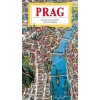
Cartoon panoramic map of Prague with a detailed illustrated guide measuring 707x1000 mm. (CZ, EN, DE)
Product detailed description
The panoramic map of the wider center of Prague expands the scope of the previous map of the historic center by another district created on the sites of historical suburbs - in the north it shows a larger part of Dejvice, the Vltava meander with Holešovice and Troja, a part of Libně and Vysočany. In the east, there are mainly neighborhoods created during the 19th century – Karlín, Žižkov, Vinohrady, Vršovice, Nusle. In the south, the map frames a part of the Pankrácká plain with contemporary modern buildings, on the right bank of the Vltava the southern part of Nové Město with Vyšehrad. Between the left bank and the western edge of the map is a larger part of Smíchov and districts such as Radlice, Košíře, Břevnov and Střešovice.
The pictorial guide on the other side of the map contains drawings and descriptions of 132 historical objects shown in the map and an orientation map of the Prague metro.
Be the first who will post an article to this item!


